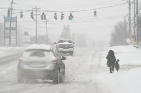
Central North Carolina is gearing up for a winter storm expected to bring snow and ice beginning Friday afternoon and lasting through Saturday morning. Forecasts suggest snowfall up to 3 inches in some areas, along with ice accumulations of up to two-tenths of an inch. The severity will vary depending on the storm’s path and interaction with existing cold air.
Winter Storm Warnings and Preparations
As of Thursday, January 9, the National Weather Service has issued a Winter Storm Warning for all of central North Carolina from 1 p.m. Friday to 10 a.m. Saturday. Southeastern counties remain under a Winter Weather Advisory for the same period, anticipating snow and sleet accumulations of up to half an inch and ice accumulations of up to one-tenth of an inch.
Governor Josh Stein declared a statewide state of emergency late Thursday. This move ensures activation of storm response resources and potential federal reimbursement. The North Carolina Department of Transportation (NCDOT) has already begun brining roads in preparation for the storm. Snow plowing and ice treatment for state-maintained roads are also on standby.
Who Will See the Most Snow?
According to forecasts, Interstate 85 serves as the general dividing line between snow-dominated and ice-dominated areas:
- North of I-85: Mostly snow.
- South of I-85: A mix of sleet, freezing rain, and possibly rain.
Forecasters caution that most areas will likely experience a mix of snow and sleet, with precipitation types fluctuating as atmospheric conditions shift.
Timing of Snowfall
Light snow is expected to move into central North Carolina from the southwest between 3 p.m. and 7 p.m. Friday.
- Southern Piedmont and Triad regions: First to see snow, starting around 3 p.m.
- Raleigh and the Triangle: Snow expected to start around 5 p.m.
- Northern Coastal Plain: Snowfall likely by 7 p.m.
Local Forecasts
Here’s what residents in key cities can expect:
- Raleigh: Snow and sleet likely before 10 p.m. Friday, transitioning to a mix of freezing rain overnight. Precipitation should taper off by 10 a.m. Saturday, with clear skies and a high of 44°F.
- Durham: Snow possible after 4 p.m. Friday, followed by sleet and freezing rain. Total snow accumulation could reach 2.5 inches by Saturday morning. Saturday afternoon will see clear skies and a high of 43°F.
- Chapel Hill: Snow and sleet expected before 10 p.m. Friday, with mixed precipitation through Saturday morning. Accumulations of up to 2 inches are forecast.
School Closures and Early Dismissals
Schools across the Triangle area are adjusting schedules in anticipation of hazardous weather:
- Durham Public Schools: Closed on Friday.
- Wake County, Orange County, and Chapel Hill-Carrboro Schools: Early dismissals planned for Friday.
Will Driving Be Dangerous?
As with hurricanes, forecasters emphasize the impact of the storm rather than specific snow or ice amounts. Hazardous travel conditions are expected from late Friday through Saturday, with potential black ice posing risks Sunday and Monday mornings.
How Cold Will It Be?
Cold temperatures will persist through the middle of next week, with highs in the upper 30s to low 40s and lows dipping into the upper teens to lower 20s. The warmest day will be Monday, with a high of 46°F.
Key Takeaways
Residents should prepare for hazardous travel conditions, potential power outages, and prolonged cold temperatures. Stock up on essentials, stay informed through weather updates, and avoid unnecessary travel during the storm.
Disclaimer – Our team has carefully fact-checked this article to make sure it’s accurate and free from any misinformation. We’re dedicated to keeping our content honest and reliable for our readers.


