Chicago, IL – Illinois is bracing for an intense Arctic air mass that will bring life-threatening cold temperatures and subzero wind chills starting Sunday. The National Weather Service has issued warnings about extreme weather conditions lasting well into next week. Residents should prepare for the freezing temperatures and hazardous travel conditions.
How Cold Will It Get?
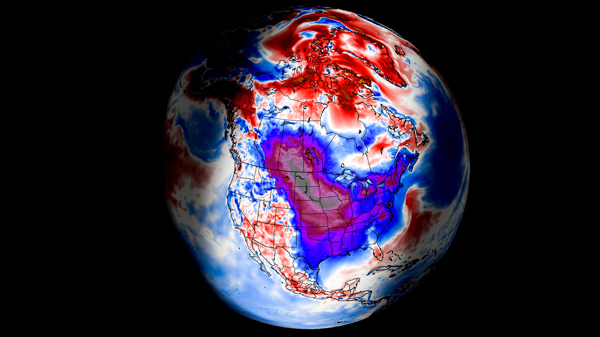
The cold front is expected to bring dangerously low wind chills, dropping as far as -30°F by early Monday and Tuesday. This severe drop in temperature increases the risk of frostbite and hypothermia for anyone exposed to the cold for extended periods.
Monday is expected to be the coldest day of the week, with daytime highs barely climbing above single digits. Nighttime temperatures will be even worse, falling into the single digits or lower.

Snow and Ice to Add to the Hazards
Along with freezing temperatures, snow and ice accumulation are expected, especially in areas along the I-55 corridor. These conditions are likely to make roads slippery and dangerous, causing travel delays and potential accidents.
The storm will bring snow showers starting Sunday, with wind gusts reaching up to 35 mph. Blustery conditions will worsen overnight into Washington’s Birthday on Monday, with lows around 2°F.
The bitter cold will continue through midweek, with high temperatures staying below freezing during the day and dropping even further at night.

How to Stay Safe During Extreme Cold
Officials are urging residents to take precautions to stay safe:
- Limit Time Outdoors: Prolonged exposure to extreme cold can lead to frostbite or hypothermia.
- Dress Warmly: Wear layers, hats, gloves, and scarves to protect yourself from the bitter cold.
- Care for Pets: Ensure your pets are indoors or have adequate shelter.
- Prepare Your Car: If you must travel, carry an emergency kit that includes blankets, water, food, and flashlights. Also, check road conditions before starting your journey.
Stay Informed and Connected
Stay updated on the latest weather alerts by following local news channels. For real-time updates, follow us on Instagram and like us on Facebook. Support local, independent news to stay informed!
Additional Weather Updates Across the U.S.
- Minnesota and Iowa: A Winter Weather Advisory remains in effect until 6 PM Saturday, with heavy snow expected.
- Wisconsin: Snowstorm warnings are predicting up to 6 inches of snow by Saturday morning.
- Vermont and Northern New York: A Winter Storm Warning is in place, forecasting up to 12 inches of snow and ice through Sunday night.
- Texas: An Arctic cold front is set to bring freezing temperatures starting Monday.
Be sure to prepare ahead of time for these winter storms and stay safe!

Disclaimer – Our team has carefully fact-checked this article to make sure it’s accurate and free from any misinformation. We’re dedicated to keeping our content honest and reliable for our readers.