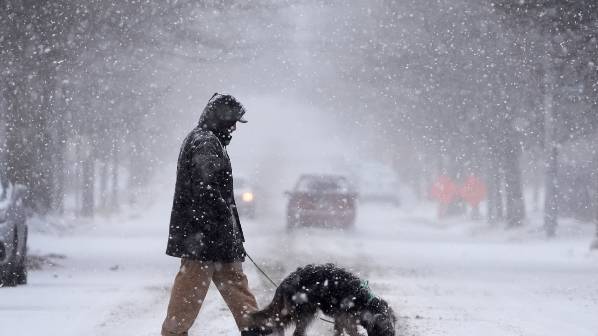
A Winter Storm Watch has been issued for Southeast New York, with forecasts predicting heavy snowfall beginning Sunday afternoon and continuing into the night. Residents are urged to prepare for hazardous travel conditions, potential power outages, and disruptions to daily routines.
Snowfall Predictions and Timing
According to the National Weather Service (NWS), Southeast New York could see snowfall accumulations ranging from 6 to 12 inches in affected areas. Snow is expected to begin around midday Sunday, intensifying in the late afternoon and evening hours. Gusty winds may accompany the snow, reducing visibility and creating dangerous travel conditions.
Meteorologists warn that the heaviest snowfall will likely occur between 4 p.m. and 10 p.m. during peak travel times, adding to the risks. Commuters and holiday travelers are advised to adjust their plans to avoid being on the roads during these hours.
Areas Under Watch
The Winter Storm Watch includes areas such as Westchester, Rockland, and Putnam counties, as well as parts of Orange and Dutchess counties. Coastal regions may experience a wintry mix or rain initially, transitioning to snow as temperatures drop throughout the day. Inland regions are expected to bear the brunt of the storm, with higher snow totals likely in elevated areas.

Potential Impacts
Heavy snow and strong winds are expected to create a range of challenges for residents and businesses in Southeast New York:
- Travel Disruptions: Snow-covered roads and poor visibility could lead to significant travel delays. Officials recommend avoiding non-essential travel during the storm.
- Power Outages: Accumulating snow on power lines and tree branches may result in outages. Residents are advised to have flashlights, batteries, and other emergency supplies ready.
- School and Business Closures: The storm may prompt closures or delays on Monday, particularly if cleanup efforts are hampered by ongoing precipitation or frigid temperatures.
Safety Precautions
Officials urge residents to take the following precautions to stay safe during the storm:
- Stock Up on Supplies: Ensure you have enough food, water, medications, and other essentials to last through the storm.
- Prepare for Power Outages: Charge electronic devices and have backup power sources ready.
- Stay Informed: Monitor weather updates through reliable sources like the National Weather Service and local news channels.
- Avoid Non-Essential Travel: If you must drive, keep an emergency kit in your vehicle, including blankets, water, and a shovel.
Emergency Preparedness Tips
New York State emergency management officials recommend checking heating systems and ensuring smoke and carbon monoxide detectors are functioning properly. Residents should also clear driveways and walkways of snow regularly to prevent ice buildup and ensure safe access for emergency services if needed.
Public Response and Resources
Local officials are coordinating with state agencies to ensure roads are pre-treated and plowing operations are ready to respond once the storm begins. Shelters and warming centers may be opened in some areas for those in need. To find the nearest resource center, visit New York State Emergency Services.

What’s Next?
Following the storm, frigid temperatures are expected to settle in, which may extend the recovery period. Cleanup efforts will likely focus on clearing major roadways and restoring power to affected areas as quickly as possible. Residents should remain cautious of icy conditions and allow extra time for travel once the storm has passed.
By staying prepared and informed, Southeast New York residents can minimize the storm’s impact and ensure the safety of their families and communities.
Disclaimer – Our team has carefully fact-checked this article to make sure it’s accurate and free from any misinformation. We’re dedicated to keeping our content honest and reliable for our readers.