This weekend, the weather is expected to be wet and windy with significant temperature drops coming next week. Let’s dive into the details of the forecast.
Weekend Weather Highlights
According to the Storm Team 11 Forecast, the skies will mostly be cloudy throughout the weekend. The chance of rain will be moderate, with a 20% chance of showers tonight. Expect temperatures to drop to 34°F tonight.
A High Wind Warning has been issued for the mountain regions of East Tennessee, from 1:00 AM on Saturday until 10:00 AM on Sunday. Areas affected include the mountains of Johnson, southeast Carter, and southeast Greene counties. These areas will experience sustained winds of 25 to 35 mph, with gusts reaching up to 70 mph. This warning indicates that travel could be hazardous in some areas, and it is advised to take precautions if you’re planning to be outdoors.
Flood Watch in Effect
A Flood Watch is also in effect from 4:00 AM Saturday to noon Sunday for southeastern Kentucky and southwest Virginia. Heavy rainfall is expected in these regions, which may lead to local flooding, especially in low-lying areas.
Saturday’s Weather
Saturday will bring a mix of sunshine and clouds, but the wind will definitely be noticeable. There’s a 50% chance of rain, with the heaviest rainfall expected in northern parts of southwest Virginia and southeastern Kentucky. Winds in the Tri-Cities will be coming from the south-southwest at 10 to 15 mph, with gusts up to 30 mph.

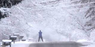
In higher elevations of East Tennessee, winds will be much stronger, ranging from 20 to 30 mph with gusts up to 60 mph. Be prepared for these gusty conditions if you’re planning to head to higher ground.
Saturday Night Forecast
By Saturday night, the weather will turn more intense. Expect mostly cloudy skies, with an 80% chance of rain and thunderstorms. Heavy rainfall is likely, particularly in some areas. Winds will shift, coming from the southwest at 5 to 15 mph, with gusts reaching 30 mph. Temperatures will be in the upper 50s to near 60°F, creating a relatively warm but windy atmosphere.
Sunday’s Weather
Sunday morning will bring heavy rain and thunderstorms before sunrise, but conditions will begin to change later in the day. Expect scattered showers, which will eventually turn into snow showers by Sunday evening. Areas at elevations above 4,500 feet could see an inch of snow, while lower elevations may receive just a light dusting.
The high temperature on Sunday will occur just after midnight, hovering in the upper 50s to near 60°F. Temperatures will quickly drop to the 40s by the afternoon. Expect a chilly night, with temperatures dropping to 23°F and light snow showers continuing.
Monday and Beyond
As we move into Monday, morning flurries are possible, particularly early in the day. The sky will clear up in the afternoon, with partly cloudy skies dominating. The high temperature will be 40°F, which is a significant drop from the weekend warmth. Monday night will be cold, with clear skies and a low of 22°F.

Tuesday will start with partly cloudy skies, and temperatures will rise to around 46°F. However, clouds will increase as the day progresses, setting the stage for more rain and snow on Wednesday.
Next Week’s Outlook
Expect a 50% chance of rain and snow on Wednesday, with the weather turning colder. The high temperature on Wednesday will be 42°F, but it will feel much colder with the wind. Snow may fall Wednesday night into early Thursday, with light snow accumulations possible. The low temperature on Wednesday night will drop to 23°F, and Thursday will see a high of around 32°F.
Thursday’s forecast calls for cloudy skies with a 40% chance of snow showers throughout the day. Expect clear skies Thursday night with temperatures plummeting to a chilly 13°F. If you have any outdoor plans, make sure to bundle up as the temperatures drop significantly.
End of Week Forecast
As the week wraps up, Friday will bring partly cloudy skies and much colder temperatures, with a high of just 34°F. With clear skies and cold winds, Friday night will see the temperatures dip further, so it’s important to prepare for the cold heading into the weekend.
Key Takeaways

- High Wind Warning for mountain areas in East Tennessee with gusts up to 70 mph.
- Flood Watch for southeastern Kentucky and southwest Virginia due to heavy rainfall.
- Rain turning into snow showers on Sunday, with snow possible in higher elevations.
- Significant temperature drops expected, with cold conditions continuing through the week.
Be sure to stay updated with the latest forecasts and take the necessary precautions, especially if you are traveling to higher elevations or expecting severe weather conditions in your area.
Disclaimer – Our team has carefully fact-checked this article to make sure it’s accurate and free from any misinformation. We’re dedicated to keeping our content honest and reliable for our readers.