Heavy Snowstorm Causes Travel Disruptions in Northwest Kansas and Eastern Colorado
Goodland, KS – Residents of northwest Kansas and eastern Colorado are facing significant travel challenges as a heavy snowstorm continues to impact the region. A Winter Weather Advisory, issued by the National Weather Service (NWS), remains in effect until 9 AM CST (8 AM MST) Saturday, covering several counties across both states.
The advisory is a clear signal for residents to take precautions, as the storm brings hazardous road conditions and travel difficulties. Officials are urging people to stay vigilant and avoid non-essential travel until the situation improves.
Counties Affected by the Snowstorm
The National Weather Service in Goodland has identified multiple counties under the advisory, including:
- Kansas Counties: Decatur, Norton, Rawlins, Sheridan, Thomas, Sherman, Logan, and Wallace.
- Colorado County: Cheyenne.
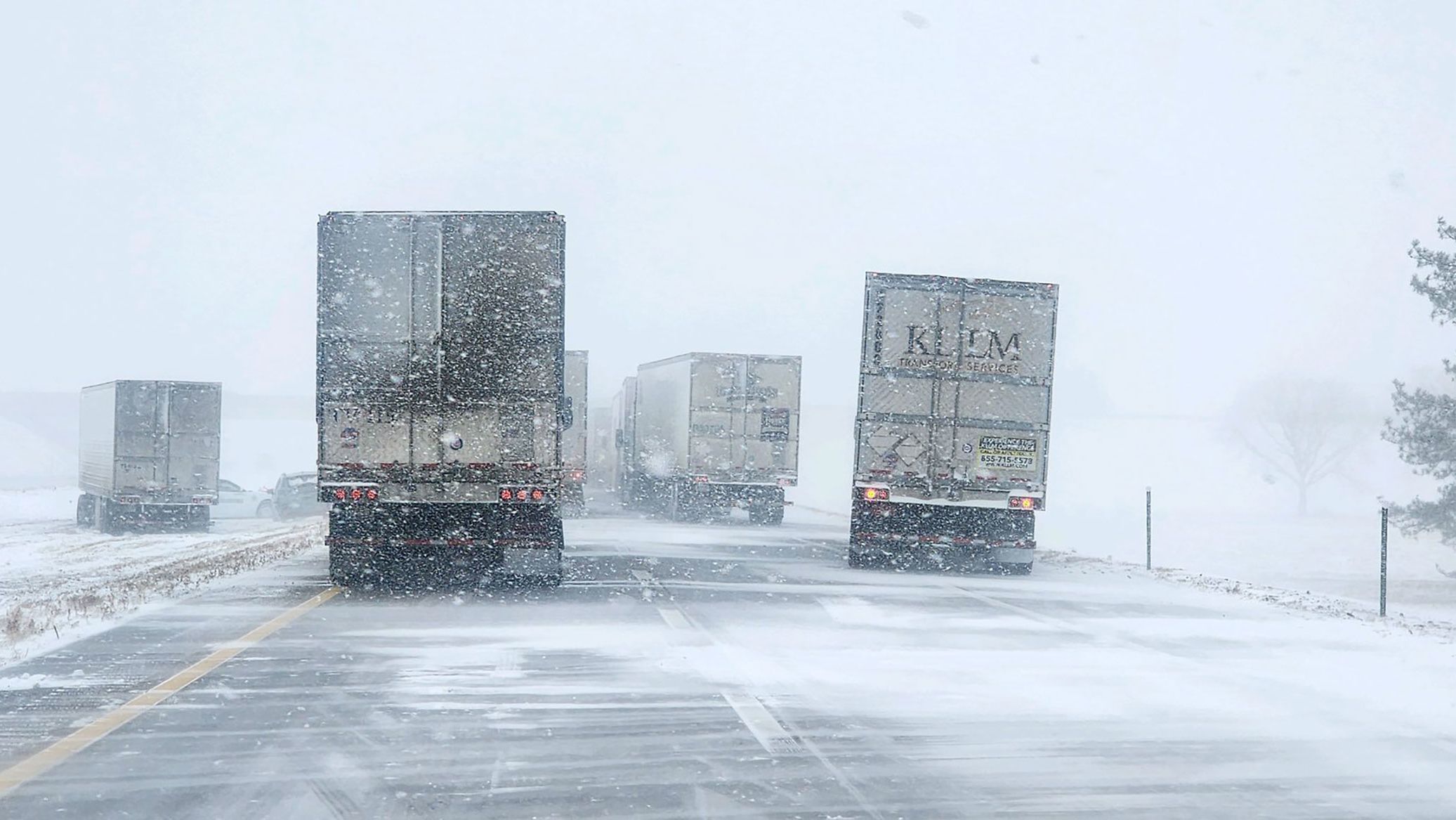
Reports from the affected regions confirm that snowfall rates are averaging 1 to 2 inches per hour, which is significant enough to disrupt normal activities. Overall, snow accumulations are expected to reach 3 inches, but some areas may experience localized totals of up to 6 inches due to heavier snow bands.
Road Conditions: Hazardous and Slick
With the ongoing snowfall, road conditions have become increasingly dangerous, particularly on bridges and overpasses where ice can form quickly. The combination of snow and the refreezing of melted precipitation has made many routes slick and treacherous.

Authorities are strongly advising drivers to:
- Reduce speed: Snow and ice reduce traction, making high speeds dangerous.
- Avoid unnecessary travel: Unless it’s essential, staying off the roads is the safest option.
- Stay informed: Use the Kansas, Nebraska, and Colorado 511 road condition services to get real-time updates on road conditions.
Another key warning from officials is to avoid relying on GPS systems for alternate routes. Some of these routes may lead to remote or less-traveled roads, which are likely to be impassable due to snow accumulation or untreated icy surfaces.
Key Safety Tips for Residents
For residents in the affected areas, it’s important to prioritize safety during this period of severe weather. Here are some essential tips to follow:
- Prepare for Delays:
If travel is unavoidable, allow extra time to reach your destination. Slow down and drive cautiously to avoid accidents. - Equip Your Vehicle:
Keep an emergency kit in your car that includes warm clothing, blankets, bottled water, snacks, a flashlight, and a first-aid kit. - Stay Indoors:
When possible, remain at home until the weather improves and roads are cleared. Traveling during peak snowfall increases the risk of accidents. - Monitor Weather Updates:
Check reliable sources like the National Weather Service (NWS) website or local news channels for regular updates on the storm and road conditions.
Timeline of the Snowstorm
The heaviest snowfall is expected to occur overnight and into the early hours of Saturday morning. By mid-morning Saturday, the intensity of the snow is expected to taper off, allowing for improved travel conditions later in the day. However, freezing temperatures may persist, keeping roads icy and slick even after the snow subsides.
Authorities’ Response
State and local authorities are actively working to mitigate the effects of the storm. Snowplows and road crews have been deployed to clear major highways and essential routes. However, the high rate of snowfall makes it difficult to keep roads completely clear in real-time.

Emergency services are also on standby to assist residents in case of accidents or other weather-related incidents. Residents are encouraged to report emergencies promptly and to avoid any activities that could put them or others in danger.
What to Expect After the Advisory Ends
Even after the Winter Weather Advisory expires on Saturday morning, residents should remain cautious. Icy conditions can persist for hours or even days after snowfall ends, particularly in shaded areas or on less-traveled roads.
Meteorologists are also closely monitoring the storm’s trajectory to assess whether additional advisories or warnings may be needed for nearby regions. For now, it appears that conditions will improve gradually over the weekend, with roads becoming more navigable as crews continue their clearing efforts.
How to Stay Informed
Staying updated is key to navigating this winter storm safely. Here are a few ways to ensure you remain informed:
- Road Conditions: Use the 511 road condition services for Kansas, Nebraska, and Colorado to check real-time updates on travel routes.
- Weather Alerts: Follow the National Weather Service (NWS) website or mobile app for the latest advisories and updates.
- Local News Channels: Keep an eye on local TV or radio stations for live coverage of the storm.
Conclusion
This heavy snowstorm is a reminder of how quickly winter weather can disrupt daily life, particularly in regions like northwest Kansas and eastern Colorado. While the advisory is expected to end by Saturday morning, the lingering effects of the storm will require residents to remain cautious and prepared.

Whether it’s staying off the roads, equipping your vehicle with essentials, or staying tuned to weather updates, a little preparation can go a long way in ensuring safety during this period of harsh winter weather.
By following safety guidelines and keeping a close eye on the conditions, residents can minimize risks and navigate through this storm with greater confidence.
Disclaimer – Our team has carefully fact-checked this article to make sure it’s accurate and free from any misinformation. We’re dedicated to keeping our content honest and reliable for our readers.