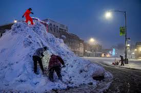
A warm front moved through the Northeast last night, leaving behind a light dusting of snow in some areas. In places like Southern New England, a few inches of snow fell. Now, we are waiting for a cold front that will pass through tonight. This will bring only a few clouds and a shift in winds from the southwest to northwest. For today, expect partly sunny skies and mild temperatures, with highs ranging from the upper 40s to mid-50s from north to south. The radar is calm, and it will stay that way for the rest of the day.
Tonight, we will see clear skies and cooler temperatures. Lows early Tuesday morning will be in the mid-30s to low 40s. Tuesday will be slightly colder, but still above average, as the temperature drop will happen gradually. Expect plenty of sunshine, but with highs topping out in the 40s to around 50°F. By Wednesday morning, temperatures will drop into the upper teens to mid-20s. On Wednesday, expect sunshine for most of the day, with clouds arriving later in the afternoon. Highs will be in the 30s.
Wednesday night into Thursday, the first of two storm systems will bring more winter weather. While not a particularly strong storm, it will cause problems with snow, sleet, and freezing rain, particularly in inland areas. Freezing rain is expected to be a major issue for parts of inland New Jersey, the Hudson Valley, and Connecticut.
The National Weather Service has issued a forecast showing a 50% or higher chance of freezing rain in areas like New Jersey, Pennsylvania, and the Catskills. The weather will remain active into Thursday, and there could be a light snow accumulation at the start before the changeover to freezing rain inland. Coastal areas will likely see rain instead of snow or ice.
Models also predict another similar storm system arriving on Saturday night, potentially bringing more snow ahead of sleet, freezing rain, and rain. Temperatures may be colder for this weekend’s storm, making snow a more likely occurrence before the sleet and freezing rain.
As always, we’ll be keeping an eye on these systems closely as the week progresses, so stay tuned for updates.
Disclaimer – Our team has carefully fact-checked this article to make sure it’s accurate and free from any misinformation. We’re dedicated to keeping our content honest and reliable for our readers.


